Explore and enjoy our beautiful walking trails:
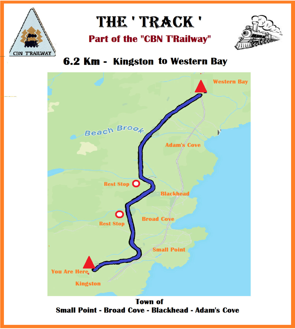
The ‘Track’
The old Railway bed, which runs the entire North Shore has been converted to a multiuse Trail , know as the CBN T’Railway. 6.2 Km of which transits through the town, most of the town trails can be accessed from this main route. There are a couple of rests near the bridges which cross both Broad Cove and Blackhead Brooks.
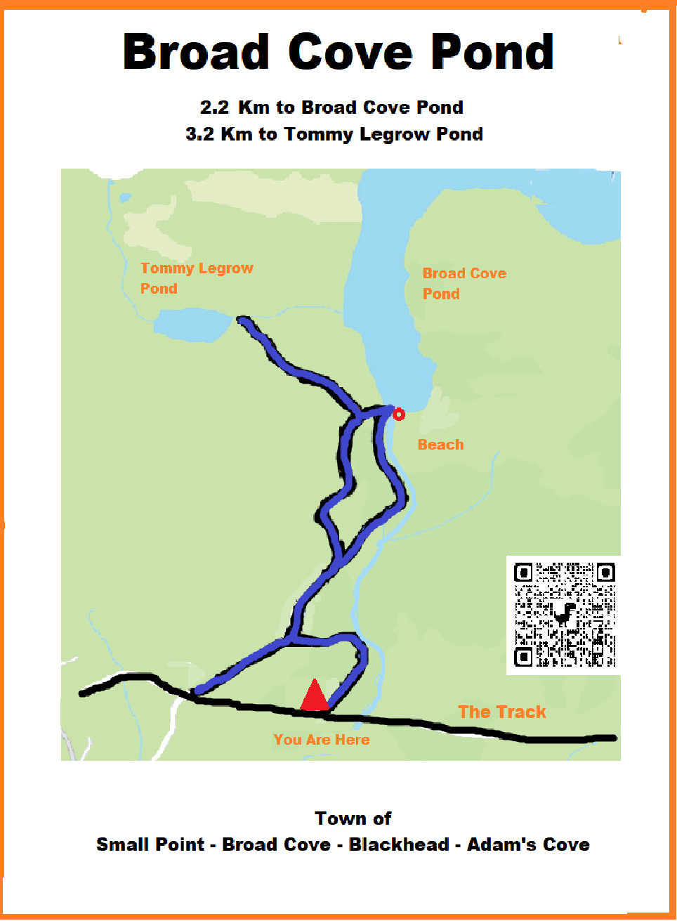
Broad Cove Pond
With several alternate routes from the Track , the pond itself is accessible by vehicle however, the the trial closest to Broad Cove Brook provides a nicer hiking path although it does have some wet areas. Broad cove pond is just over 2 Km in from the Track. The trail continues another 1 Km on to Tommy LeGrow Pond and then out of the community to other ponds.
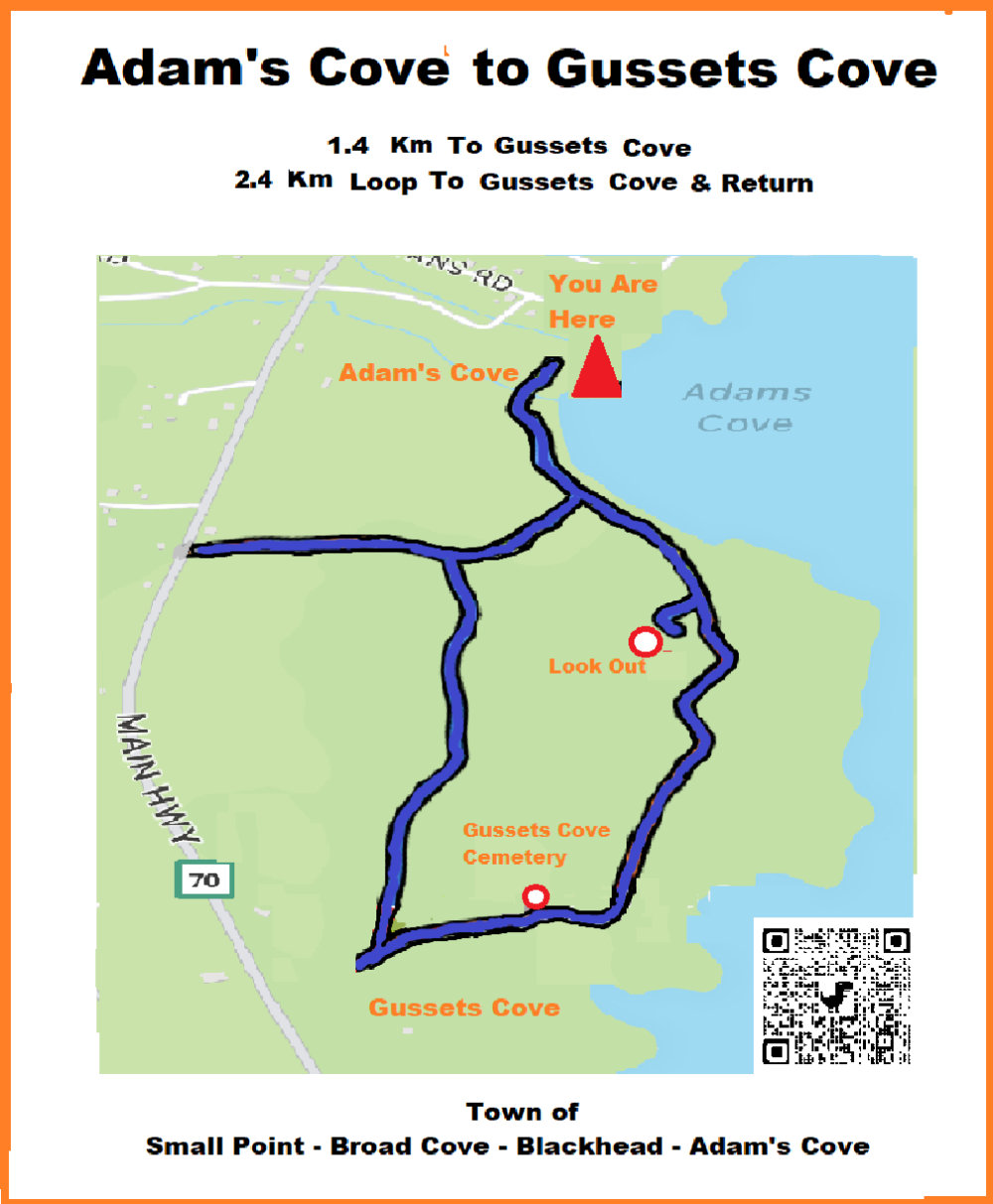
Gussetts Cove To Adam’s Cove
This Trail has ocean views , it runs 1.4 Km from Gussetts Cove near the Old Cemetery to the beach in Adam’s Cove , there is also a 2.4 Km loop option with a nice woods walk , and there is a spectacular look out point on the route.
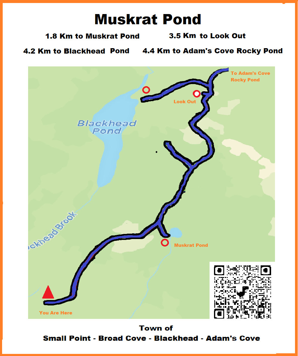
Muskrat Pond
This trail provides a great access to the interior of the town , Muskrat pond is the first of the accessible ponds approximately 2 Km in. From here the trail can get wet in places but ultimately the far end of Blackhead Pond and Adam’s Cove Rocky Pond can be accessed . There are many side paths which are most wood cutting areas but it is great exploring.
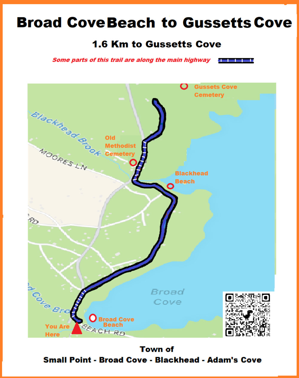
Broad Cove Beach to Gussetts Cove
This 1.6 Km interconnection of Trails takes you from Broad Cove Beach through Broad Cove North and Blackhead and by Blackhead Beach. Note: there are 2 short sections that bring you onto the Main highway along the route.
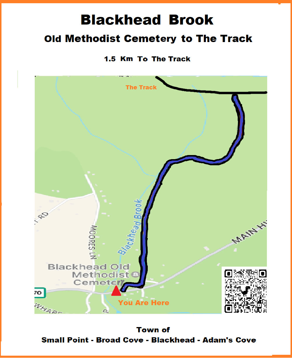
Blackhead Brook
This short 1.5 km Trail along Blackhead Brook can be used to connect the Track and interior trails and the coastal routes. It has at one end the Old Methodist Cemetery.
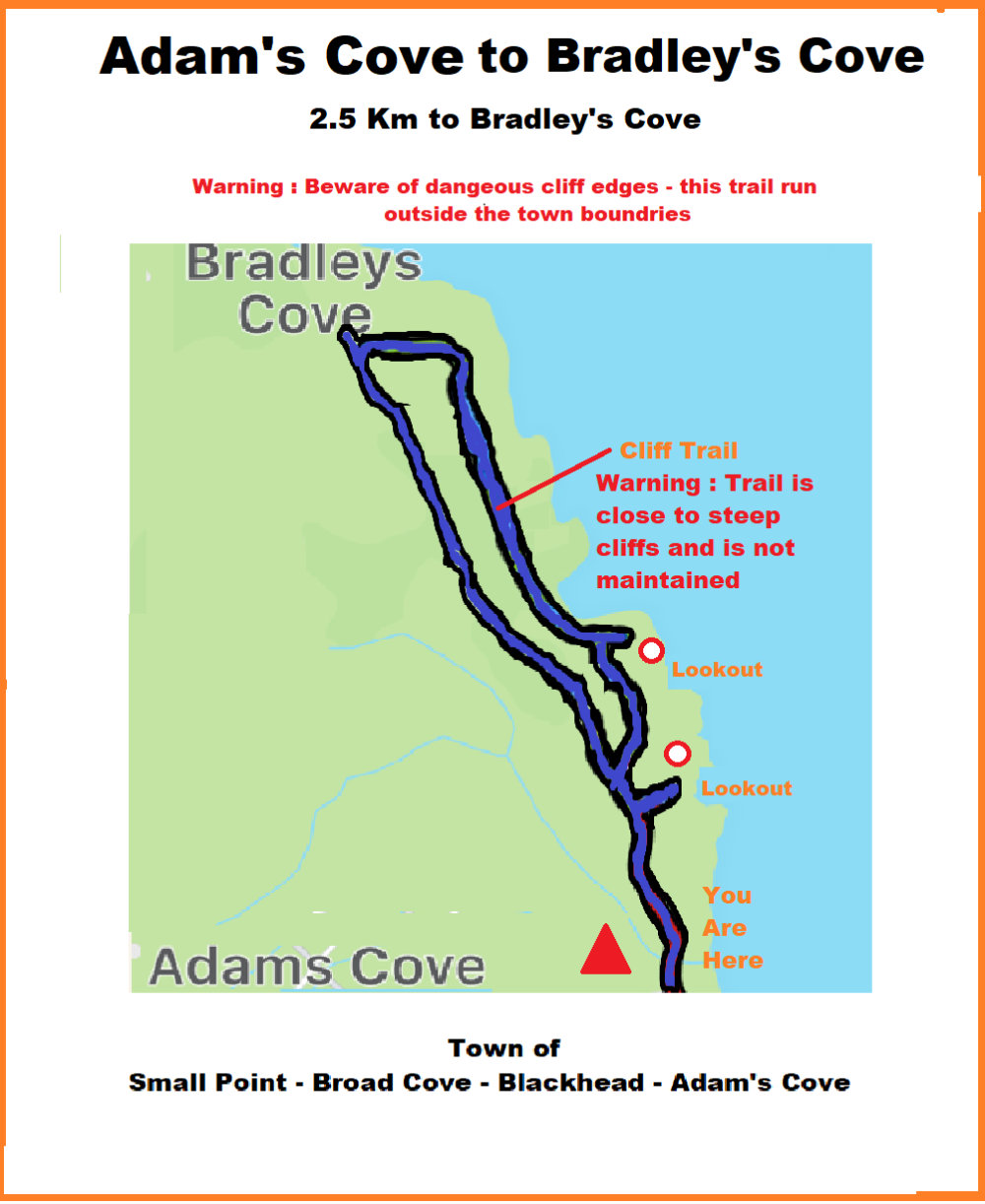
Adam’ Cove to Bradley’s Cove
A 2.5 Km route that can bring you along the cliff edges from Adam’s Cove to Bradley’s Cove. Amazing views but be aware the trail is along an unmaintained area with steep cliffs. There is an interior old roadway which can be used for alternate route, or to create a loop of the trail.
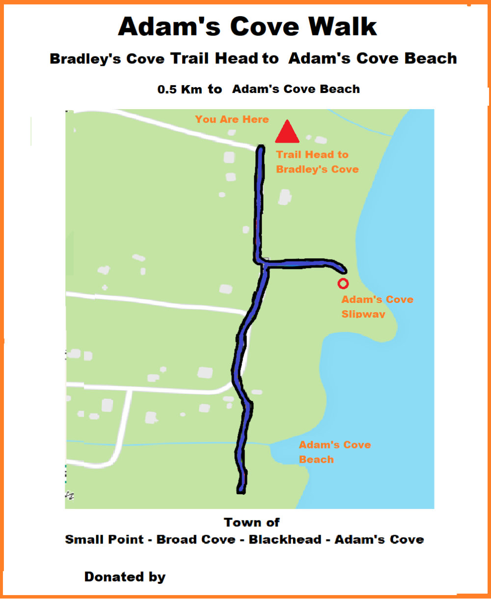
Adam’ Cove Walk
This short 0.5 Km walk though the shore edge of town takes you from the Adam’s Cove beach to the Trail head leading to Bradley’s Cove
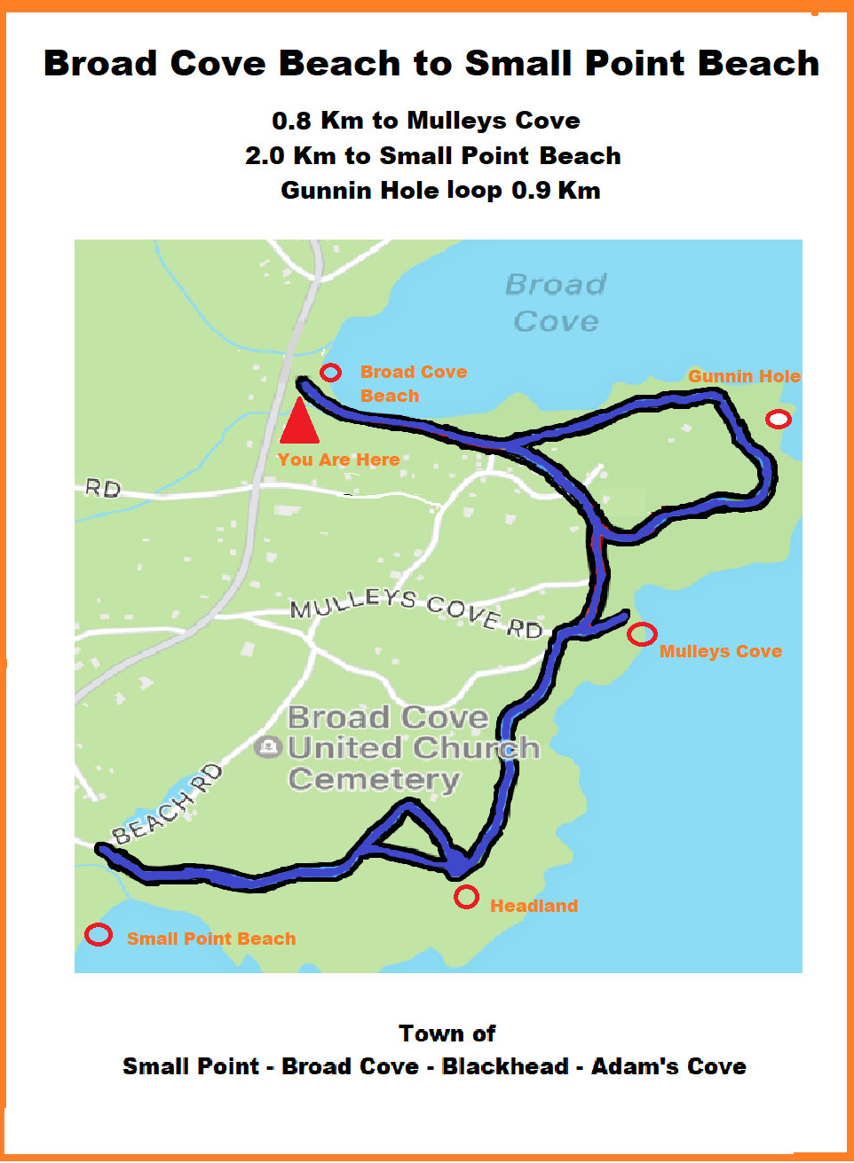
Broad Cove Beach to Small Point Beach
This 2.0 km trail routes through Broad Cove from Broad Cove beach to the secluded Small Point Beach. Along the way you pass through Mulley’s cove and there is a great lookout point on the headland. There is also loop in the route that brings you to an costal outcrop known as the Gunnin Hole.